



Once, I became really interested in searching for high-altitude hill stations. And by high, I mean properly high. Back then, while browsing through Wikipedia and going down random YouTube rabbit holes around 2012, I came across something that genuinely made me stop for a moment.
A place in Bengal sitting above 3,500 metres, and one that you could actually reach by vehicle.
No multi-day trek. No porter. Just a rough mountain road, a machine built like a tank, and a destination that offers one of the most iconic mountain views on the planet.
That discovery planted a seed. It took a while, but eventually I made it there. And it was worth every year of waiting.
What is So Special About Sandakphu?
Sandakphu is the highest point of West Bengal at roughly 3,636 meters, straddling the border between India and Nepal. It is known on the Nepali side as Sandakpur.
But the altitude alone is not what draws people here.
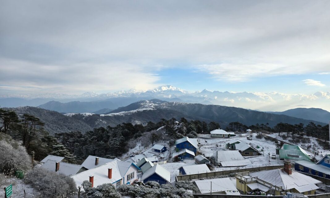
What makes Sandakphu genuinely one of a kind is the view it offers on a clear morning. From its ridgeline, you can see four of the tallest mountain peaks on Earth standing together in one sweeping panorama: Mt Everest, Mt Kanchenjunga, Mt Lhotse, and Mt Makalu. Together, the silhouette they create against the sky resembles a giant figure lying peacefully on its back, eyes closed, arms folded. Trekkers have been calling it the Sleeping Buddha for generations, and once you see it, you understand immediately why.
The most iconic way to reach this summit is by Land Rover, the old Defender series that has been navigating these mountain trails for decades. These are not modern luxury SUVs. They are loud, bouncy, thrillingly impractical machines that somehow manage to climb terrain that looks impossible from the ground. Riding in one up to Sandakphu is an experience in itself, separate from the destination entirely.
My Trip To Sandakphu in April
The Planning and the Budget Reality Check
Like my Kheerganga trip, this was also supposed to be a solo trip. Well, that’s what my initial plan was, but eventually I had to become part of a group. Which honestly turned out to be a good thing later.
As we know, Sandakphu can mainly be reached in two ways, by trekking or by Land Rover.
And while researching the trip, both options genuinely looked equally exciting to me.
The trekking route is what most people dream about. Starting from Manebhanjan, the trail slowly climbs through pine forests, bamboo stretches, fog-covered roads, and tiny Himalayan settlements like Chitrey, Tonglu, Tumling, and Kalipokhri. Every place somehow feels like a scene from an old mountain film.
For trekking lovers, Sandakphu is almost an emotion at this point. Especially among Bengalis.
I read blogs where people described unbearable leg pain in one paragraph and then called it one of the best experiences of their lives in the very next line. Which I think perfectly summarizes trekking psychology.
But then came the practical side of things.
I had limited time. And that completely changed the plan. That’s when I started looking more seriously into the famous Sandakphu Land Rovers.
These old vintage vehicles are legendary by themselves. Watching them climb those brutal rocky roads almost feels scientifically questionable at times. The roads are so rough and steep that sometimes you genuinely wonder whether the vehicle will survive the next turn.
But somehow they do. Slowly, loudly and heroically.
Nowadays, Boleros are more commonly used on the route because they are easier to maintain and more practical for regular trips. But the Land Rovers still remain a huge part of Sandakphu’s identity.
Then I checked the pricing, and reality slowly entered the chat.
A reserved Land Rover from Manebhanjan to Sandakphu and back costs between ₹5,500 and ₹7,000, plus extra overnight driver charges. Divided among a group, it is manageable. For a solo traveler, it is steep.
Then came the homestays. Sandakphu is not a quick day trip where you snap photos and leave; you have to stay overnight in places like Tumling, Kalipokhri, or Sandakphu itself. Since homestays enforce a two-bed minimum per room, going solo meant paying for an empty bed.
Add up the permits, transport to Manebhanjan, vehicle charges, and lodging, and suddenly my budget was climbing more aggressively than the mountain roads. At one point, I was sitting there calculating everything like a middle-class finance minister:
- Train tickets
- Shared transport
- Land Rover charges
- Homestays
- Food
Every new calculation somehow made the total bigger than the previous one. And then, something funny happened.
As usual, Google and Facebook had probably been tracking every single thing I was searching for.
Sandakphu this. Land Rover fare that. Tumling homestay. Trek routes. Sunrise viewpoints. Everything.
And luckily, one random advertisement suddenly appeared in front of me that looked exactly like what I needed. ₹8990. NJP to NJP.
Permit, Stay and transportation included at Manebhanjan, Sandakphu, and Tumling.
The moment I saw that package, the entire trip suddenly started looking possible again. And for the first time during all that planning and budget calculation, I finally relaxed a little.
Without wasting much time, I booked it immediately and reserved my place.
Reaching New Jalpaiguri
New Jalpaiguri, or NJP as most travellers know it, is the most popular base station for anyone planning to head into North Bengal. Trains from Kolkata arrive here directly, and the station has a steady, organised buzz to it that makes getting your bearings fairly simple. The taxi stand just outside is where most mountain bound journeys begin, and mine was no different.
All I got was a seat in Shatabdi and for this reason had to stay for a night in a nearby hotel, which was not that great.
My tour agency had already arranged everything in advance. An SUV was booked, and after checking out early, I made my way to the taxi stand to wait for the rest of the group. One by one the other travellers arrived, introductions were exchanged, bags were loaded, and we set off.
The Road to Manebhanjan
Manebhanjan, the small border town that serves as the gateway to Sandakphu, is not a short drive. It takes a few hours, and somewhere along the way the city noise fades completely and the mountains start taking over the view outside your window.
We made two stops along the route. The first was for breakfast at a simple roadside place, the kind where the food is plain but the portions are generous.
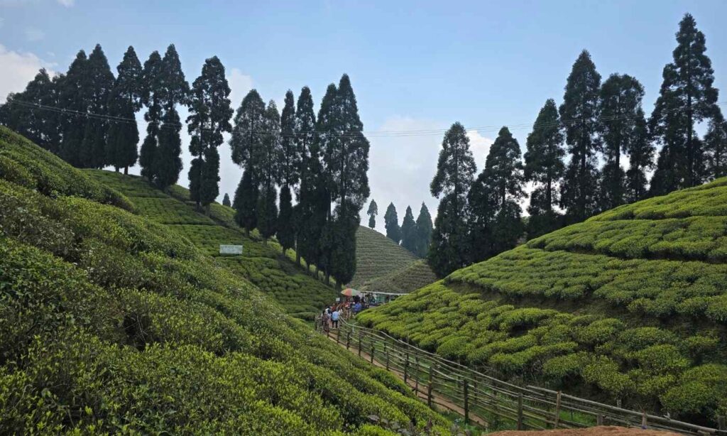
The second was at Gopaldhara Tea Estate, which was an unexpected highlight. If you have only ever seen tea gardens from a distance on a train, stepping inside one is a different experience altogether. The rows of trimmed bushes stretch up the hillside in perfect symmetry, and the air carries a freshness that is difficult to describe but impossible to forget.
We also passed through Simana, a small settlement that marks the border between India and Nepal. There was no dramatic checkpoint, no grand monument announcing it. Just a quiet road passing through two countries at once.
We reached Manebhanjan at around 2 PM and checked into Pradhan Hotel, which sits right beside the Land Rover Association office. It is a convenient and comfortable enough base, exactly what you need the night before a mountain drive.
Exploring Mane Bhanjang
Elevation: 6,325 ft / 1,946 m (some sources cite 2,150 m)
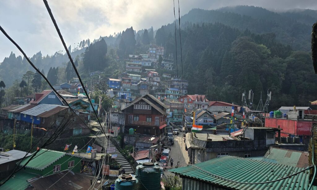
Since the Sandakphu journey was planned for the next morning, we had the rest of the afternoon and evening to explore the town.
Manebhanjan is a small transit town in Singhalila ridge, which is at around 6,325ft, or 1,946m. However in some places it says that height is 2,150 meters (7,054 ft).
So is Manebhanjan just a transit town? Or does it actually have something unique of its own?
The most unique thing about this town is that it is split between two nations. I have seen videos of travellers stepping dramatically from one country into another at such borders, making a show of it. The reality here is more understated and, because of that, far more interesting. A narrow drain is said to mark the division between India and Nepal. That is it. One step and you are technically in a different country, but nothing around you changes. The same mountains, the same sky, the same small shops lining the road.
What you will find on a walk through town is a Mahadev temple, a Buddhist chorten that you can spot fairly easily, and the most unique thing is the Land Rovers.
This place is also known as the Land of Land Rovers. For years, these old vintage vehicles were the main way to reach Sandakphu through the steep and rocky mountain roads. They carried tourists, trekkers, supplies, and local people across routes where ordinary vehicles could barely survive. Even today, a few of them can still be seen around the town, almost like moving pieces of history.
But nowadays, Boleros have slowly taken over most of the route. They are faster, more practical, and easier to maintain for these mountain drives. During my journey too, I travelled in a Bolero, bouncing through rocks, mud, fog, and endless uphill bends toward Sandakphu.
You will find these vehicles parked almost everywhere, waiting for the next day’s passengers and another climb into the mountains.
Upon crossing the border you can see farm lands, the step farming that we used to study, small shops, tea stalls, Ilam local police station, and locals casually going on with their day as if these dramatic Himalayan roads are completely normal. And maybe that simplicity is what makes the place feel so memorable.
Dinner that evening was simple. Nothing elaborate, nothing fancy. But the vegetables tasted the way vegetables are supposed to taste when they have not been sitting in a cold store for a week. There is something about mountain freshness that makes even a modest meal feel satisfying in a way that a restaurant back in the city rarely manages.
Manebhanjan to Sandakphu
As said, Manebhanjan is the base village from where people usually begin their Sandakphu journey, either by trekking or by taking a Land Rover or Bolero uphill.
Before starting, some paperwork is involved. The route passes through protected forest and border areas, so photocopies of ID cards are required. I had completely forgotten this, and found myself sprinting to a nearby photocopy shop at the last minute. One copy goes to the Singalila Land Rover Owners’ Welfare Association when booking the vehicle; the other is verified at the entry checkpost before entering the Singalila route.
After breakfast, we had booked a Bolero instead of the classic Land Rover. A practical decision, honestly. Though I will admit, part of me still wanted that old Defender experience. Maybe next time.
Chitrey
Elevation : 8,340 feet/2,542 meters
The drive begins with a steep climb almost immediately after leaving Manebhanjan. And when I say steep, I genuinely mean it. The track looked less like a road and more like a collection of jagged rocks somehow stitched together across the mountainside. Our Bolero growled, climbing slowly through the mist as if it had made this exact journey a thousand times before.
Very quickly, the plains started to feel like a distant memory. The air became thinner, colder. Pine trees appeared around every bend, prayer flags fluttered from unseen corners, and the heavy silence of the mountains slowly swallowed the noise of ordinary life.
By the time we reached Chitrey, the first major stop on the route, the wind had picked up considerably. It was the kind of wind that instantly reminds you that you have left the lowlands far behind. I stepped out of the vehicle, and within seconds, the mountain cold hit my face properly for the first time.
And honestly, I loved it.
Chitrey itself felt tiny, peaceful, and almost suspended in time. Just a small Himalayan settlement sitting quietly among the clouds and pine forests.
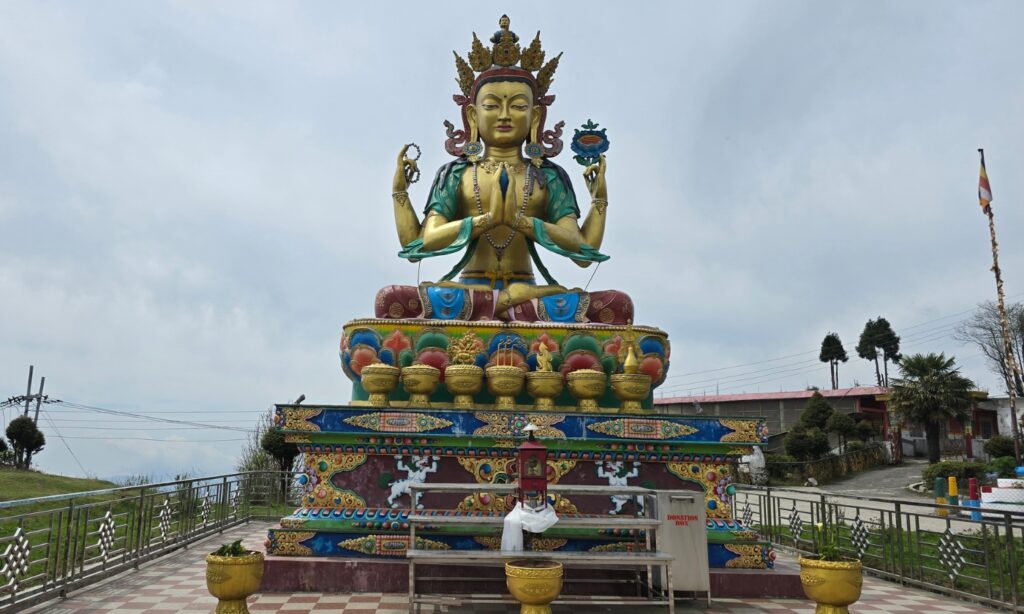
One of the first things that catches your attention is the beautiful monastery and the towering thirty five foot statue of Avalokiteshvara standing gracefully beside the road. With colourful prayer flags dancing wildly in the mountain wind around it, everything felt cinematic. It is one of those places where even silence somehow feels loud.
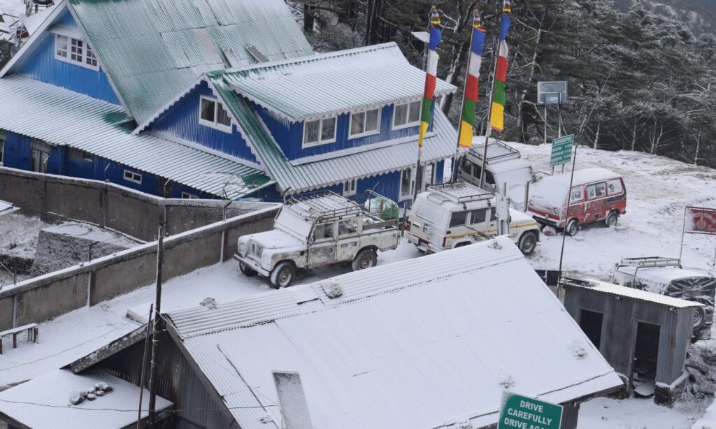
Trekkers rested nearby with heavy backpacks slung over their shoulders, sipping hot tea before continuing the long uphill climb toward Tonglu and Tumling. A few vintage Land Rovers stood parked along the roadside, almost like tired mountain horses waiting for the next ascent.
I walked around for a while with my camera, trying not to miss any corner of the place. But within a few minutes, the altitude and short uphill hike had already started making me feel tired.
After finishing almost an entire one-litre water bottle in one go, I boarded the Bolero again, and our journey continued further into the mountains.
Megma
Elevation: 8,500 ft / 2,600 m
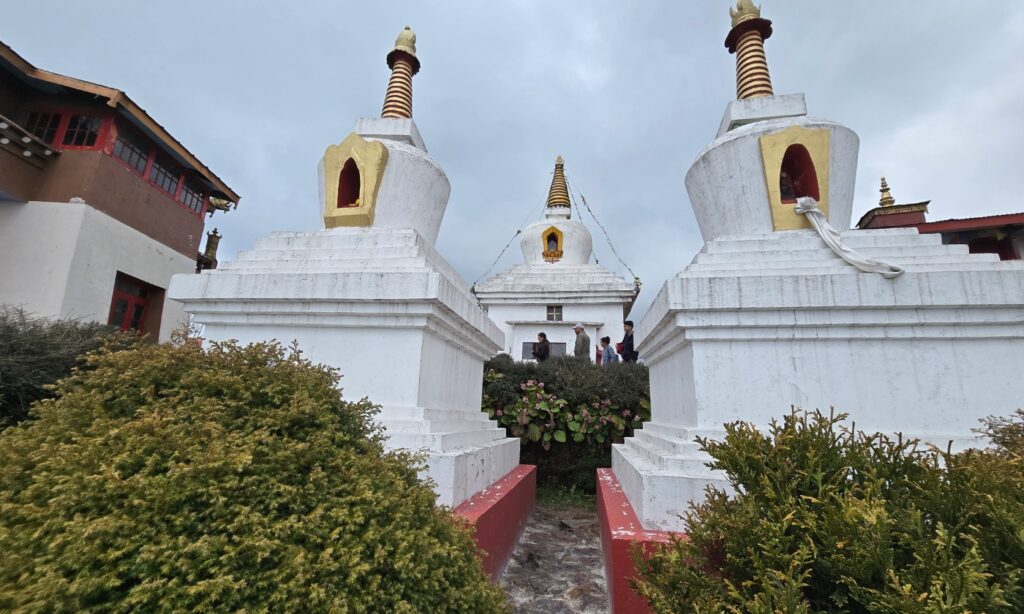
After Chitrey, the road kept climbing higher through forests and clouds. I must say the roads were much nicer than I expected.
Usually you can see Khangchendzonga/ Kanchanjunga, while riding through this road but we were not that lucky as it was completely overcast.
Slowly we reached Meghma, a small village near the India-Nepal border. By then, the temperature had dropped noticeably, and stepping out of the Bolero for a few minutes felt refreshing.
Meghma means “land of clouds” in Nepali.
“Megh” means cloud, and “ma” refers to a place or land. The name fits perfectly because the village is almost always surrounded by mist and drifting clouds.
The entire area usually remains covered in mist, with prayer flags fluttering in the wind and a few small houses quietly standing beside the road.
Just near the monastery there is an SSB post so photography is prohibited. There is also a beautiful homestay.
After getting down and exploring the monastery, we were back in our Bolero. This time I felt less tired.
Tonglu
Elevation: 9,960 feet/3,036m
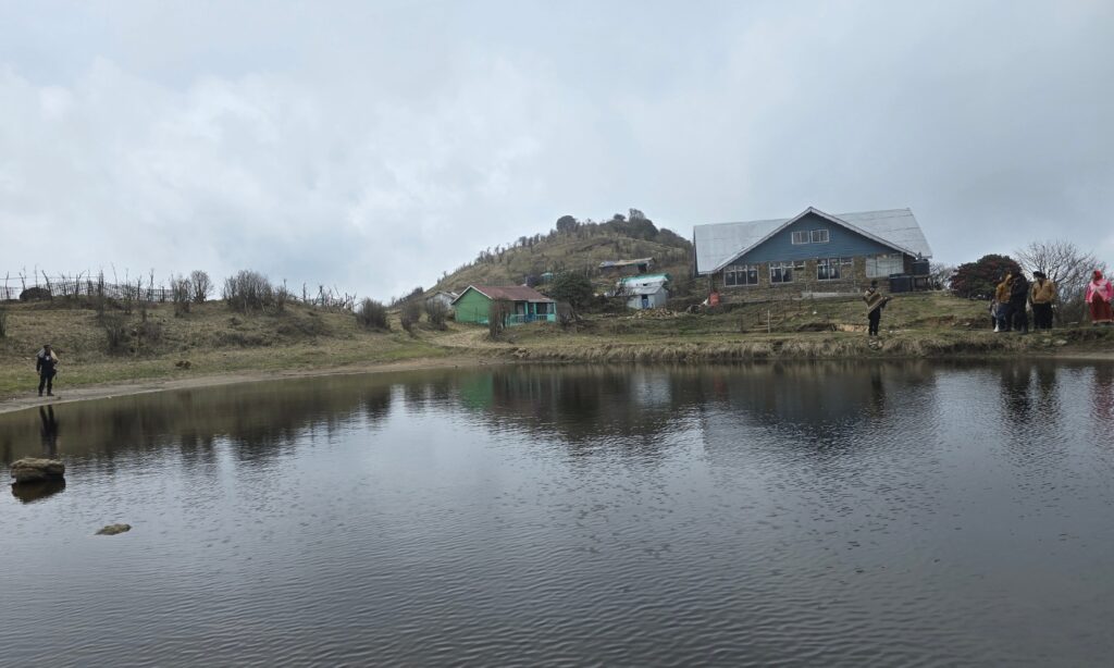
Tonglu was easily my favourite stop on the drive up.
Our Bolero halted, and I stepped out to explore. It was really windy, and reminded me of my Ladakh trip that I made in April.
Being a small settlement you won’t need much time to explore. There is a small, still pond sitting right at the edge of the trail, and beside it, a cozy tea house with benches where you can just sit and breathe for a moment. The surrounding hills feel incredibly close here.
As I walked around, the vibrant colours of blooming rhododendrons caught my eye, standing out beautifully against the heavy mist of the mountain.
Usually, Tonglu offers a magnificent view of the famous Sleeping Buddha formation, almost as beautiful as Sandakphu itself. But once again, the weather remained overcast. I kept hoping the skies would clear by the time we reached Sandakphu. Though, even a foggy and mist-covered mountain landscape has its own charm.
But honestly, whom was I kidding?
Nothing compares to witnessing the majestic Sleeping Buddha standing above the clouds.
Tumling
Elevation: 9,744 feet/2,970m
The next settlement after Tonglu is Tumling.
By the time we reached here, it had become too misty. Clouds kept floating across the roads, sometimes clearing for a few seconds before covering the hills again. Just like any remote settlement in the Himalayas, you can see small wooden homestays, prayer flags, tea stalls.
Tumling is known for its beautiful mountain views and peaceful atmosphere. Many trekkers spend a night here before continuing toward Kalipokhri or Sandakphu. Also many tourists coming by Landrover/Bolero choose this option to spend a night, particularly when they start late.
We skipped a dedicated stop at Tumling since we had a stay planned there on the way back.
Entering Singalila National Park
The route to Sandakphu passes through Singalila National Park, a protected forest known for its red pandas, Himalayan black bears, and endless stretches of rhododendron forests.
As we continued uphill, we passed through dense forests lined with rhododendron trees. A few flowers had started blooming here and there, but most of the branches were still bare. Our driver explained that due to late snowfall that season, many of the rhododendrons had not fully blossomed yet.
Usually during April, these forests turn into vivid shades of red and pink, covering the mountainsides with colour. But even without full bloom, the forest felt beautiful in its own way. The trees stood densely packed on both sides of the rough mountain track, making the drive feel sheltered, quiet, and at times almost otherworldly.
While entering the national park area, checking and permit verification are done properly. Our vehicle stopped briefly at the entry point where IDs and documents were verified before we were allowed to continue further toward Sandakphu.
Gauribas
Elevation : 8,600 feet/2,621 metres
Gauribas was our tea halt on the ascent. It is a small cluster of shelters perched along the trail, popular with both trekkers on foot and vehicle travellers. I am not a tea drinker, so I used the time to walk around and take in the view while the others warmed their hands around their cups.
Kalipokhri
Elevation: 10,450 feet/3,186 metres
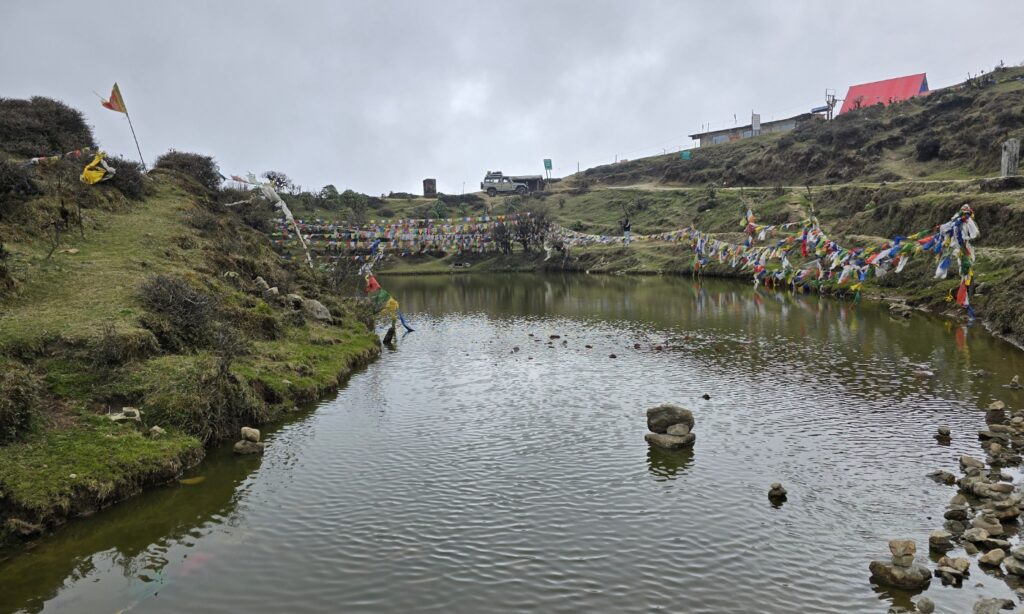
We were slowly getting closer to our final destination. The next major stop on the route was Kalipokhri.
In Nepali, “kali” means black and “pokhri” means lake. The place is named after the small dark lake sitting quietly beside the trail, surrounded by prayer flags and mist-covered hills. At this altitude, the entire place somehow feels calm and slightly unreal at the same time.
The moment I stepped out of the Bolero, the wind hit properly. It was so windy that you honestly did not need to make a timelapse to show how fast the clouds were moving.
Everything around us kept changing every few seconds. Fog drifting. Prayer flags flying wildly. Clouds swallowing entire hills and revealing them again.
The place looked beautiful.
Beside the lake, colorful prayer flags fluttered endlessly in the cold wind, while the fog kept rolling across the roads and nearby slopes. At a distance, a small chorten stood quietly overlooking the area, along with a Mani wall decorated with prayer wheels and colourful floral patterns.
Kalipokhri felt like one of those places where you could easily spend a few peaceful hours doing absolutely nothing.
But the wind was becoming stronger, Sandakphu was still ahead of us, and more importantly, we had not even eaten lunch yet.
The Final Stretch
I looked outside the car window and the road ahead genuinely felt like a staircase.
Just without the stairs.
The climb was unbelievably steep, and the road itself was made entirely of uneven rocks, making the ride even bumpier. Every few minutes the Bolero jumped hard enough to make me question whether my internal organs were still in their original positions.
Later, I remembered watching in a vlog that drivers actually prefer these rocky roads. During rainfall, normal muddy roads become dangerously slippery, while these stone-covered tracks provide better grip for the tyres.
Still, “better grip” does not necessarily mean “comfortable.”
Sharp bends, loose stones, muddy patches, and continuous uphill climbs kept appearing one after another. And to make things even more adventurous, thick mist had completely taken over the roads by then. Visibility was probably less than 10 metres at certain points. At least that’s all I could see from my seat.
Honestly, it felt like the driver was casually driving inside a cloud.
But thankfully, nobody can drive fast on these roads anyway, so that itself becomes the safety feature.
And strangely, despite all the violent shaking and endless bouncing, nobody inside the vehicle really complained much.
Because by then, Sandakphu finally felt close.
Arriving at Sandakphu
Elevation: 11,930 feet/3,636 metres
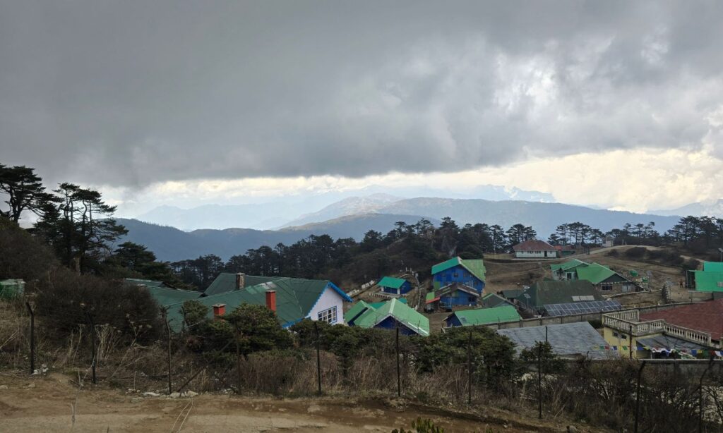
After all the bouncing, shaking, tilting, and silent prayers inside the Bolero, we finally reached Sandakphu.
We were staying at Sunrise Hotel, probably one of the most well-known places to stay near the summit. By the time I dropped my bags inside the room, my body had fully understood what those mountain roads had done to it.
My roommate and I quickly headed for lunch. There was a simple buffet arrangement, and after that journey, even basic food started tasting five-star.
Just outside the hotel, a few benches were placed along the ridge facing the Himalayan range. On clear days, this is where people sit quietly watching the Sleeping Buddha and the endless snow peaks stretching across the horizon.
But of course, the mountains had other plans for us.
Clouds had completely taken over Sandakphu by then. Thick fog surrounded everything, and just as we finished eating, a light drizzle started. Visibility dropped so much that even nearby buildings started looking unsure about their own existence.
Still, sitting inside the room felt boring, so my roommate and I decided to explore the area on foot. Interestingly, our hotel was on the Nepal side, and walking toward the Bengal side took barely a few minutes. Just cold wind, mist, and an uphill walk that constantly reminded us we were close to 12,000 feet.
Eventually, we reached the highest point of West Bengal.
And felt a bit of achievement, although the Himalayas had disappeared behind thick clouds. No Sleeping Buddha. No Everest. Nothing. Just fog standing there confidently like it had personally booked the view for itself.
But honestly, reaching there really felt special.
After returning to the hotel, both of us collapsed into bed and took one of those deep mountain naps where you wake up confused about the year, the time, and occasionally your own existence.
Exploring Aal View Point
Elevation: 11,844 feet/3,610 metres
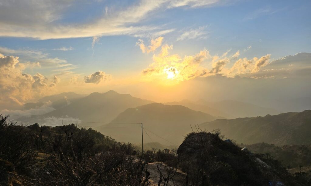
My plan had always been to explore Aal Valley by doing a small hike to witness the sunset it is famous for. But after spending the entire day surrounded by clouds, almost everybody had already given up hope of seeing any proper sunset at all.
And after lunch and a warm blanket inside a cold mountain room, sleeping felt like the smarter option.
But then again, sleeping too much while travelling, especially at a place like Sandakphu, somehow feels like wasting the mountains.
So later in the afternoon, we decided to push ourselves a little further and walk toward Aal, a viewpoint near Sandakphu known for offering one of the clearest views of both the Everest range and the Kanchenjunga range.
Now I want to be honest here.
At nearly 12,000 feet, even normal walking starts feeling different. You walk for a few minutes and suddenly your lungs start negotiating terms and conditions with you. At least that’s what was happening to me. My roommate, meanwhile, was walking perfectly fine as if we were casually strolling through a city park.
And what bothers me most during these hikes is downhill sections. At first, they feel amazing. Easy. Relaxing. But deep down you know one painful truth.
You do have to return.
And it definitely will not be downhill then.
We kept following the trail, though at certain points multiple paths appeared and naturally we chose the one that “looked correct.” Later, after checking Google Maps, I realized we had drifted slightly off route.
Not dangerously lost, just mountain-lost.
The trail we took was a bit longer, which added a few extra minutes and a very unnecessary amount of panic. In mountains, even a tiny wrong turn immediately convinces your brain that you are about to feature in a National Geographic survival documentary.
Thankfully, we found the route again and reached Aal in around 45 minutes. At least that’s what we thought.
There were few homestays here too.
By that point, I was gasping for breath and desperately searching for an excuse to sit down for two minutes without looking weak. We saw one hiker who had just come out from one of the homestays. We asked her, “Is this Aal viewpoint?”
She looked slightly unsure and said, “Yes, I think so.”
The moment she said yes, I silently thanked God because finally I could sit down and catch my breath properly.
But while she was still talking, her friend walked out from one of the homestays holding a cup of tea for her. She immediately asked him, “Is this Aal?”
He casually replied, “Yes, this is a viewpoint. But the main viewpoint is up there.” Then he pointed toward an even steeper trail going uphill.
I looked at the trail, and then at my roommate. Big mistake. Because my roommate instantly became excited and said, “Let’s go.”
Meanwhile, I was mentally preparing a speech on why this current viewpoint was already enough for humanity.
But unfortunately, self-respect exists. So I followed him.
Eventually, we reached one of the places near the top and found a beautiful panoramic opening surrounded by clouds and rolling hills. This time, I officially gave up my self-respect and immediately sat down saying, “This is awesome. Let me at least capture a timelapse now.”
The sun was still there, blurred softly behind layers of clouds.
The mountains, however, remained hidden.
No Sleeping Buddha, no Everest range, nothing.
But just before sunset, something beautiful still happened.
The sun slowly disappeared behind the clouds, painting the sky in soft golden and orange shades. The peaks never revealed themselves, but the way the light spread across the misty landscape still looked surreal.
And sitting there quietly in the cold wind, I could almost imagine how magical the entire scene would have looked if the mountains had appeared fully.
Maybe imagination becomes stronger at altitude.
The Night at Sandakphu
By the time we walked back, it was close to 6 PM and the hotel had laid out snacks and tea for guests. I sat with the group, tired and content, with the kind of tiredness that comes from a full day well spent.
Dinner was a quiet affair, a delicious fried rice and chilli paneer.
Afterwards, I stepped outside on an impulse, not expecting much. The clouds had partially broken. A section of sky above had cleared and stars were visible in patches, appearing and disappearing as the remaining clouds drifted past. I stood there longer than I planned to.
The Morning I Had Been Waiting For
I had set my alarm for 4 AM. Not because anybody asked me to, but because I did not want to miss even a single minute of whatever Sandakphu decided to offer that morning.
The moment the alarm rang, I was awake.
I quickly got ready and asked my roommate if he wanted to join. He looked half asleep and half dead and replied, “I am not feeling well… need some more sleep. Will join later.”
Fair enough.
So I stepped out alone through the hotel lobby and pushed open the main door.
And instantly realized it had snowed.
The benches outside the hotel were covered in white. A thin fresh layer of snow had quietly settled across the ground overnight, softening everything around it. Even the silence somehow felt deeper.
My camera was already in my hands by then.
A few other people from our group had clearly made the same life decision and were already outside waiting in the cold. Together, we slowly climbed to the hotel rooftop.
The sky was still dark, but not fully black anymore. Slowly, faint shades of blue and grey started appearing behind the clouds. Then the eastern horizon began changing colours altogether.
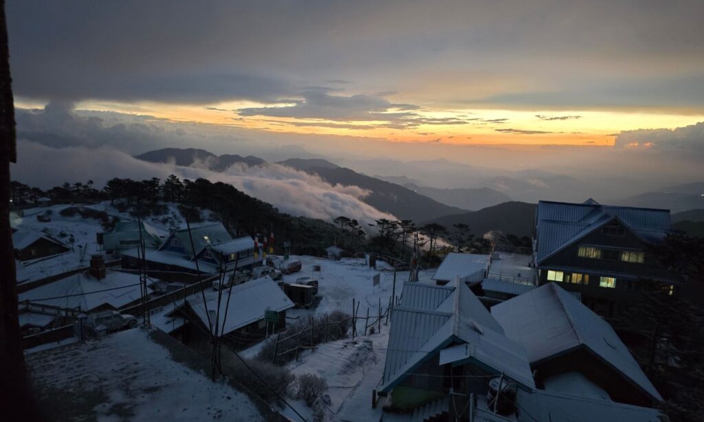
The sun itself was still hidden somewhere behind thick clouds, but the light coming from beneath them transformed the entire sky. The clouds below looked like a giant moving ocean, glowing softly from underneath.
And then, through occasional gaps in the clouds, fragments of the famous Sleeping Buddha started appearing.
Not fully.
Just pieces of it, certain parts, to be honest not clear enough to be captured.
But then the mood of nature seems to have turned off further.
A massive dark cloud started moving in from the west and quickly swallowed the entire landscape. The sunlight disappeared completely, visibility dropped again, and within minutes, snowfall started once more.
At first lightly.
Then properly.
Most people from the hotel came outside by then, enjoying the snowfall, taking photographs, laughing, throwing snow at each other, behaving exactly the way humans are supposed to behave during unexpected snowfall.
And honestly, I was enjoying it too.
But soon the wind became much stronger, and the snowfall intensified. So I retreated back to the room for a while to warm myself up.
Still, something inside me refused to accept that the morning was over.
So after some time, I wore my snow gloves, picked up the camera, and climbed back to the rooftop.
The snowfall had slowed down.
And then it happened.
When the Sleeping Buddha Revealed Itself
The clouds slowly started parting apart. Not dramatically. Not instantly. Almost theatrically, as if the mountains themselves had decided the timing was finally correct.
And suddenly, the Sleeping Buddha appeared in full. Cloud parted its way just like a cinematic way, well not in sequence though. First appeared Kumbhakarna (7,710 metres), also known as Jannu, forming the head of the Sleeping Buddha. Then slowly the gigantic snowy mass of Mount Kanchenjunga (8,586 metres) emerged through the clouds, dominating the entire skyline.
By then, the clouds have already been cleared and surrounding peaks also became visible, completing the famous formation. Kabru (7,412 metres), Kabru North (7,338 metres), Kabru South (7,318 metres), Pandim (6,691 metres), and Rathong (6,679 metres). The entire range finally formed the exact sleeping silhouette people travel all the way to Sandakphu to witness. And honestly, for a few moments, it did not even feel real.
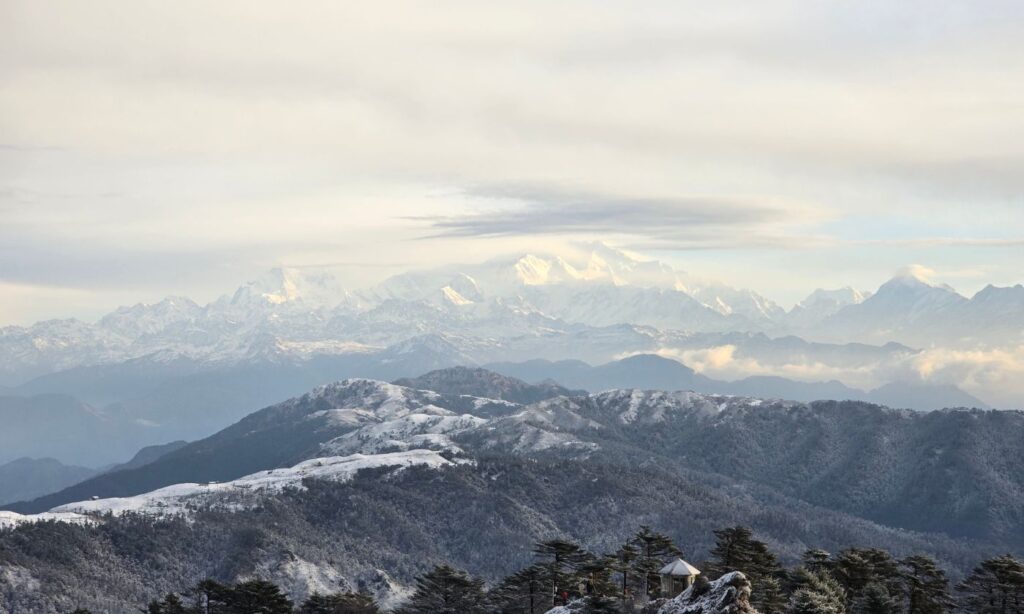
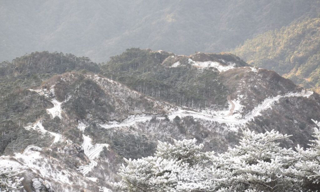
Everyone on the rooftop went silent for a second before excitement completely took over. Some people shouted. Some laughed. Some simply stood there frozen with cameras in their hands.
And, I was probably doing all three internally. Everyone was happy; their trip was a success.
And then, as everyone was busy with Mt Kanchenjunga, on the far west even the Everest range started becoming visible in the distance.
First appeared Mt Makalu at 8,485 metres, looking taller than everything around it from that angle, then Mount Everest at 8,848 metres and Mt Lhotse at 8,516 metres.
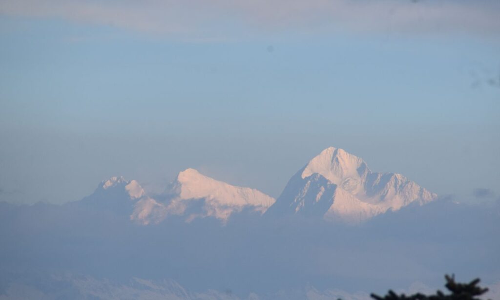
Seeing these giants appear one after another through moving clouds felt almost unreal.
Breakfast With That View
A breakfast buffet was arranged for us: Sel roti, poha, dal, and namkeen sewaiyan.
Breakfast tasted different that morning. Or maybe it tasted exactly the same and the view through the window was adding something that no kitchen can produce. Either way, I ate slowly and did not want to leave the table.
Plan to Thakum Valley
10,000 feet (3,050 meters)
We had originally planned to stop at Thakum on the way back. But after the snowfall, the tracks had become much more slippery and risky.
Still, the group was quite eager to visit Thakum somehow.
The driver, however, did not seem very convinced.
At one point, he probably overheard some of the group members saying, “Maybe he is not feeling confident enough, so let’s not go.”
That instantly activated something inside him.
He immediately replied, “Let’s go.”
And just like that, the journey began again through the same route I had hiked the previous evening toward Aal.
Our first halt was Aal Valley. This time, parts of the area were covered in fresh snow, which somehow made the landscape look even more beautiful. The trails, the grass, the rooftops, everything had turned partially white overnight.
The rest, however, remained mostly the same.
Or rather, even cloudier.
The mountains were completely hidden again behind thick fog. We walked around for a while, clicked photographs, and enjoyed the snowfall atmosphere anyway.
After some time, the driver came toward us and said, “The roads have become more slippery because of the snowfall.”
Honestly, none of us argued much after hearing that. Considering the weather, we already knew there was almost no chance of seeing any mountain ranges from Thakum that day.
So eventually, we agreed to drop the plan.
Tumling and an Early Departure
Elevation: 9,744 ft / 2,970 m
Tumling was our overnight stop, and we checked into Sheker Lodge. It is a warm, simple place with a good view and enough comfort to make you feel looked after after two days on the mountain.
However, the rest of my time in Tumling did not go as planned. My roommate’s health had not improved and I accompanied him back down to Sukhiya Pokhri, the nearest point where proper medical help was available. The doctor advised that we head back to Siliguri to be safe. So that is what we did.
It was the right decision, even if it meant leaving the mountains earlier than planned.
A Few Things Worth Knowing Before You Go
Sandakphu gets extremely cold even outside winter, particularly if you are going in April. It was very windy and just like me, you may also get to experience the snowfall. Carry more layers than you think you need. The weather at that altitude changes fast, and the difference between midday and evening temperatures can be startling.
If you are hoping to see the Sleeping Buddha clearly, try visit in between November to March, or if you are visiting in April, early morning is your best window. Clouds build over the ridge as the day progresses, and by afternoon the view is often completely covered. Do not sleep in.
When travelling to Sandakphu, it is always better to reach Manebhanjan (Maneybhanjyang) a day early and spend a night there before continuing uphill. If you plan to skip Manebhanjan, then consider staying at Tonglu or Tumling instead of going directly to Sandakphu in one stretch.
Sandakphu sits at nearly 12,000 feet, and the sudden gain in altitude can cause altitude sickness, which may sometimes become severe. The nearest proper medical assistance is available at Sukhiapokhri, which is quite far from Sandakphu. So for the safer side, allowing your body some time to adjust to the altitude with a night halt at Manebhanjan is always a wise decision.
The route from Manebhanjan/Manebhanjyang passes through Singalila National Park and you will need a permit, which your tour agency can typically arrange. Make sure this is confirmed before you start. However you can also travel alone or in a group just remember to book the homestays/hotels before starting the trip.
Booking a Land Rover or even a Bolero in advance is strongly recommended, especially during peak season. The vehicles fill up quickly and last minute arrangements can leave you stranded in Manebhanjan.
And if you get only a two minute glimpse of Everest through a gap in the clouds on a snowy morning, standing on a hotel rooftop in your gloves while everyone around you holds their breath, that is enough. Believe me. That is more than enough.
Wrapping Up
Looking back, the trip did not go exactly as planned.
The solo trip became a group trip. Thakum did not happen. The rhododendrons were not in full bloom. My roommate fell ill. We left Tumling earlier than expected.
And yet.
Standing on that rooftop in snow gloves at 4 AM, watching Kanchenjunga slowly emerge through the clouds after two days of fog. That moment alone was worth the entire journey.
Sandakphu has a way of doing that. It takes everything from you slowly. The comfortable roads, the reliable weather, the clear views. And then at the very last moment, when you have almost stopped expecting anything, it gives you something that you will not forget for a very long time.
I still want to go back.
For the full rhododendron bloom, for a clear morning at Thakum, for a proper Land Rover ride instead of the Bolero, and mostly just for those mountains.
But mostly just for those mountains.
Once you have seen the Sleeping Buddha, even partially, even briefly, through a gap in the clouds on a cold snowy morning, you will understand why people keep coming back.
The seed that was planted back in 2012 while scrolling through Wikipedia.
It has grown into something a little bigger now.
The mountains have their own sense of timing. You do not plan around it. You simply show up and wait, and when the clouds finally part, you understand exactly why you came.
